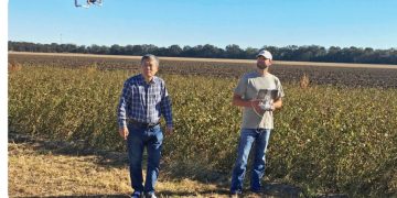
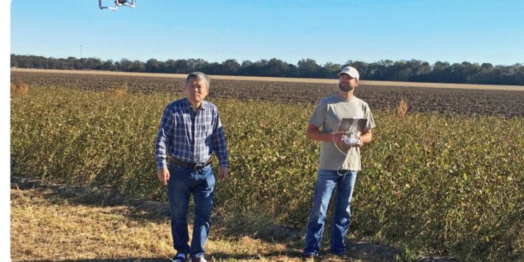
The premise that drones will change the landscape of agriculture has been around for several years now. As recently as 2016, the MIT Technology Review said drone usage was “revolutionizing” farming.
While drones in the field – whether for crop monitoring or spraying – is on the rise, the hype machine seems to have slowed. Drone usage is a part of farming’s future, but suggesting drones will reinvent agricultural probably borders on being hyperbole.
“Drones won’t take the place of airplanes, but they will find a place in pesticide application,” Dominic LaJoie, vice president of environmental affairs, National Potato Council, said during the recent Potato Expo in Austin, Texas.
Pesticide and herbicide application is becoming more feasible, but – like most other uses researchers see for drones – not to the point of being readily available for growers. Ian MacRae, professor and Extension entomologist, University of Minnesota, who has done extensive research using drones, spoke on the subject during the recent Great Lakes Fruit, Vegetable & Farm Market EXPO in Grand Rapids, Michigan.
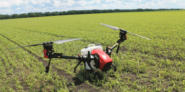
In terms of spray application, MacRae said affordable drones can only carry about 10 pounds of product at a time, which hardly makes them efficient for large fields.
“It’s really not for conventional application yet,” he said.
Here is what MacRae had to say on a variety of topics involving drone technology.
Remote sensing
“What’s driving this whole idea behind drones and remote sensing is the advances in technology,” MacRae said. “Although the drones are getting a lot of attention, the drone is really just a flying tripod. The real story comes with the sensors. Like with cell phones, everything gets smaller, quicker, better and cheaper. That’s what’s happening with sensors.”
For example, MacRae said a four-sensor device that measures wavelengths to detect unhealthy plant activity that ran for about $8,000 just a few years ago is roughly half that today.
Thermal cameras
The way remote sensory technology works is by sending multiple wavelengths toward the plant and monitoring what’s reflected back. The most telltale is near-infrared light, MacRae said. A reduced amount of reflected infrared light is a sign of a stressed plant, but that isn’t a new finding. Where the advancement is happening is in the use of temperature-sensitive cameras.
“Quite frequently, with insects and diseases, the impact that will have is both they’ll sit on the same wavelength,” MacRae said. “But diseases, theoretically, interrupt the plant’s thermal regulation more than insects. So we can use the thermal to sort out whether we’re dealing with an insect or a disease.
“These thermal sensors are so small, we can actually mount them on a drone at the same time as the other sensors.”
Dependability
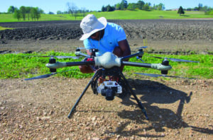
The cost of the drones themselves is coming down, along with sensory equipment and cameras, but it’s still a fine line on balancing investment with risk. As MacRae said, if you fly a drone, that drone will crash at some point.
“There is a lot of variety out there. You can go for a large one. We fly those, but we also start to segue over to smaller, less expensive vehicles,” MacRae said. “The rationale for that is when one of these things crashes – you notice I didn’t say ‘if’ — but when it crashes, you’re out a lot less money. The DJI S1000, they’re about $4,000. The 3DR Solos are about $300. They function the same way, and they’re about as reliable. The difference is the S1000 is a much heavier payload, so we use it for much larger sensors.”
GIS in software development
Sensors and cameras have the capability to accumulate vast amounts of data and hundreds of images from a single drone trip to the field. Without proper software to organize and decipher the data, it’s relatively useless to growers. Advancement in that area is ongoing, MacRae said.
“We worked on ways to measure defoliation using aerial imagery. … We realized this isn’t the way this is going to be adopted first,” MacRae said. “We needed to find software that was going to be much more amenable to the growers. We started looking at geographic information software (GIS). This is something that is becoming very commonly available. It’s responsible in auto-steering in tractors. We actually trained the GIS to say ‘this is plant material’ and ‘this is not.’ At that point, a GIS is designed to tell you what kind of coverage you have in a certain area.”
On the horizon
MacRae works more with potatoes than any other crop. His team is looking at ways they can use sensors to detect PVY and late blight, among other diseases, using remote sensing on drones and added that nutrient measurement is also in the works. Irrigation and pesticide and herbicide application might be the biggest areas of focus in the coming years, however.
“One of the things that’s probably really important in the next couple of years is spray drift, especially with the impact that it can have on potatoes and the carryover of herbicide,” MacRae said.
Another tool
Stakeholders are watching drone development with a keen eye, but that isn’t translating to investment right now, MacRae noted. The return on investment just isn’t there yet.
“There is still a lot of technology that needs to be improved,” he said. “When I talk to stakeholders, they’re interested in the data, but they’re not interested in being the one to acquire the data. Consequently, I think we’ll see adoption coming from service models.
“That’s the thing to keep in mind — drones are going to change the amount of information you have and help you make decisions, but they’re not going to replace anything,” MacRae added. “It’s just going to be another data source.”
— Zeke Jennings, VGN correspondent
